
上党镇 topographic map
Interactive map
Click on the map to display elevation.
About this map
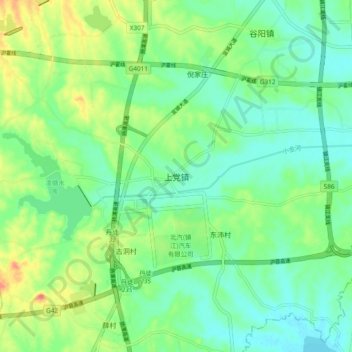
Name: 上党镇 topographic map, elevation, terrain.
Location: 上党镇, 镇江市, 江苏省, 212100, 中国 (32.03391 119.37447 32.11391 119.45447)
Average elevation: 29 m
Minimum elevation: 8 m
Maximum elevation: 71 m
Other topographic maps
Click on a map to view its topography, its elevation and its terrain.