
Zion topographic map
Interactive map
Click on the map to display elevation.
About this map
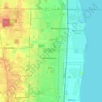
Name: Zion topographic map, elevation, terrain.
Location: Zion, Lake County, Illinois, 60099, États-Unis d'Amérique (42.43068 -87.89814 42.49394 -87.79670)
Average elevation: 198 m
Minimum elevation: 173 m
Maximum elevation: 247 m
Other topographic maps
Click on a map to view its topography, its elevation and its terrain.
Great Lakes
États-Unis d'Amérique > Illinois > Lake County > North Chicago
Great Lakes, North Chicago, Lake County, Illinois, 60088, États-Unis d'Amérique
Average elevation: 201 m
Deer Park
États-Unis d'Amérique > Illinois > Lake County
Deer Park, Lake County, Illinois, États-Unis d'Amérique
Average elevation: 253 m
Mundelein
États-Unis d'Amérique > Illinois > Lake County > Mundelein
Mundelein, Lake County, Illinois, États-Unis d'Amérique
Average elevation: 231 m