
Thank you for supporting this site ❤️
Make a donation
Make a donation
Ramersbach topographic map
Click on the map to display elevation.
Thank you for supporting this site ❤️
Make a donation
Make a donation
Ramersbach
Ramersbach liegt ca. 8 km südlich der Kernstadtteile von Bad Neuenahr-Ahrweiler am Kreuzungspunkt der Landesstraßen 84 und 85 und bildet den geographisch höchstgelegenen (der topographisch höchste Punkt heißt „Häuschen“ auf einer Höhe von 506,5 m ü. NHN), geschichtlich jedoch jüngsten Stadtteil von Bad Neuenahr-Ahrweiler.
Thank you for supporting this site ❤️
Make a donation
Make a donation
About this map
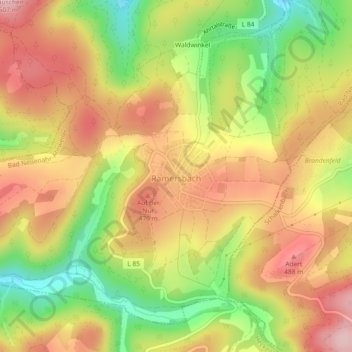
Name: Ramersbach topographic map, elevation, terrain.
Average elevation: 414 m
Minimum elevation: 298 m
Maximum elevation: 508 m
Thank you for supporting this site ❤️
Make a donation
Make a donation