
Thank you for supporting this site ❤️
Make a donation
Make a donation
Derby topographic map
Click on the map to display elevation.
Thank you for supporting this site ❤️
Make a donation
Make a donation
About this map
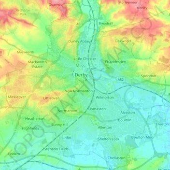
Name: Derby topographic map, elevation, terrain.
Location: Derby, East Midlands, England, United Kingdom (52.86103 -1.55686 52.96813 -1.38307)
Average elevation: 70 m
Minimum elevation: 36 m
Maximum elevation: 149 m
Thank you for supporting this site ❤️
Make a donation
Make a donation
Other topographic maps
Click on a map to view its topography, its elevation and its terrain.
Thank you for supporting this site ❤️
Make a donation
Make a donation
Wakebridge
United Kingdom > England > Derbyshire > Amber Valley > Crich Carr > Wakebridge
Average elevation: 181 m