
Wayne topographic map
Interactive map
Click on the map to display elevation.
About this map
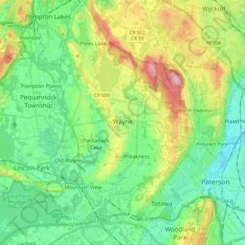
Name: Wayne topographic map, elevation, terrain.
Location: Wayne, Passaic County, New Jersey, 07470, United States (40.88287 -74.28928 41.01404 -74.19554)
Average elevation: 86 m
Minimum elevation: 9 m
Maximum elevation: 261 m
Other topographic maps
Click on a map to view its topography, its elevation and its terrain.
Hughes Lake
United States > New Jersey > Passaic County > Passaic
Hughes Lake, Passaic, Passaic County, New Jersey, United States
Average elevation: 30 m
High Crest Lake
United States > New Jersey > Passaic County > West Milford > Smiths Mills
High Crest Lake, Smiths Mills, West Milford, Passaic County, New Jersey, United States
Average elevation: 219 m
Paterson
United States > New Jersey > Passaic County
Paterson, Passaic County, New Jersey, United States
Average elevation: 54 m