
麻车屯 topographic map
Interactive map
Click on the map to display elevation.
About this map
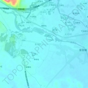
Name: 麻车屯 topographic map, elevation, terrain.
Location: 麻车屯, 金田村, 桂平市, 贵港市, 广西壮族自治区, 中国 (23.56735 110.07250 23.60735 110.11250)
Average elevation: 49 m
Minimum elevation: 38 m
Maximum elevation: 176 m