
盖州市 topographic map
Interactive map
Click on the map to display elevation.
About this map
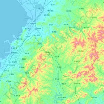
Name: 盖州市 topographic map, elevation, terrain.
Location: 盖州市, 营口市, 辽宁省, 中国 (39.91899 121.94410 40.56482 122.89175)
Average elevation: 201 m
Minimum elevation: -1 m
Maximum elevation: 1,106 m
Other topographic maps
Click on a map to view its topography, its elevation and its terrain.