
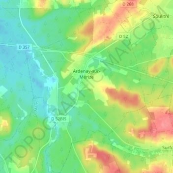
Ardenay-sur-Mérize topographic map
Interactive map
Click on the map to display elevation.
About this map
Name: Ardenay-sur-Mérize topographic map, elevation, terrain.
Average elevation: 90 m
Minimum elevation: 62 m
Maximum elevation: 135 m
Other topographic maps
Click on a map to view its topography, its elevation and its terrain.
Loué
França > País do Loire > Sarthe > Loué
Loué, La Flèche, Sarthe, País do Loire, França metropolitana, 72540, França
Average elevation: 96 m