
Katete topographic map
Interactive map
Click on the map to display elevation.
About this map
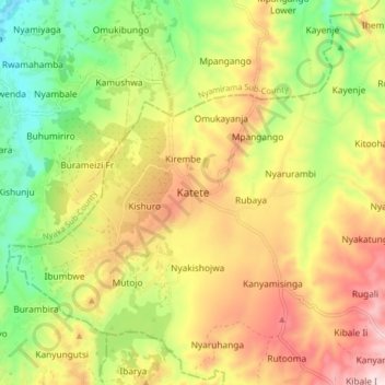
Name: Katete topographic map, elevation, terrain.
Location: Katete, Kambuga Sub-County, Kanungu, Western Region, Uganda (-0.82181 29.71458 -0.74181 29.79458)
Average elevation: 1,285 m
Minimum elevation: 1,082 m
Maximum elevation: 1,508 m