
Guilford County topographic map
Interactive map
Click on the map to display elevation.
About this map
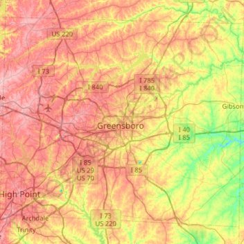
Name: Guilford County topographic map, elevation, terrain.
Location: Guilford County, North Carolina, United States (35.90005 -80.04691 36.25430 -79.53200)
Average elevation: 239 m
Minimum elevation: 166 m
Maximum elevation: 308 m
Other topographic maps
Click on a map to view its topography, its elevation and its terrain.
Haywood County
United States > North Carolina
Haywood County, North Carolina, United States
Average elevation: 1,045 m