
Yanapata topographic map
Interactive map
Click on the map to display elevation.
About this map
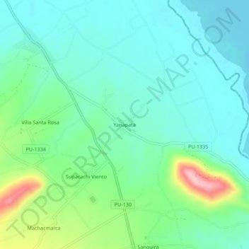
Name: Yanapata topographic map, elevation, terrain.
Location: Yanapata, Yunguyo, Puno, Perú (-16.32426 -69.07706 -16.28426 -69.03706)
Average elevation: 3,854 m
Minimum elevation: 3,812 m
Maximum elevation: 3,981 m
Other topographic maps
Click on a map to view its topography, its elevation and its terrain.
Plaza de Armas
Plaza de Armas, Acari, Yunguyo, Puno, Perú
Average elevation: 3,851 m