
San Sisto topographic map
Interactive map
Click on the map to display elevation.
About this map
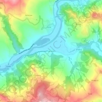
Name: San Sisto topographic map, elevation, terrain.
Location: San Sisto, Todi, Perugia, Umbria, 06059, Italia (42.74668 12.35043 42.78668 12.39043)
Average elevation: 231 m
Minimum elevation: 133 m
Maximum elevation: 398 m
Other topographic maps
Click on a map to view its topography, its elevation and its terrain.