
Arica topographic map
Interactive map
Click on the map to display elevation.
About this map
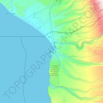
Name: Arica topographic map, elevation, terrain.
Average elevation: 523 m
Minimum elevation: 0 m
Maximum elevation: 3,622 m
More than 20 km of beaches, many known for the quality of surfing, span across the Coastal Range in the northern sector. The harbored location makes these beaches unique from other cities in Chile in terms of topography.