
Valdoviño topographic map
Interactive map
Click on the map to display elevation.
About this map
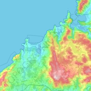
Name: Valdoviño topographic map, elevation, terrain.
Location: Valdoviño, Ferrol, La Coruña, Galicia, España (43.54878 -8.22378 43.66981 -8.01913)
Average elevation: 84 m
Minimum elevation: -5 m
Maximum elevation: 357 m
Other topographic maps
Click on a map to view its topography, its elevation and its terrain.