
Thank you for supporting this site ❤️
Make a donation
Make a donation
Mkushi topographic map
Click on the map to display elevation.
Thank you for supporting this site ❤️
Make a donation
Make a donation
About this map
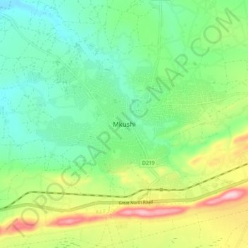
Name: Mkushi topographic map, elevation, terrain.
Location: Mkushi, Mkushi District, Central Province, Zambia (-13.65886 29.35123 -13.57886 29.43123)
Average elevation: 1,281 m
Minimum elevation: 1,197 m
Maximum elevation: 1,454 m
Thank you for supporting this site ❤️
Make a donation
Make a donation
Other topographic maps
Click on a map to view its topography, its elevation and its terrain.