
Lee County topographic map
Interactive map
Click on the map to display elevation.
About this map
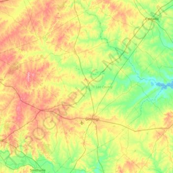
Name: Lee County topographic map, elevation, terrain.
Location: Lee County, Texas, United States (30.03205 -97.33462 30.55722 -96.64051)
Average elevation: 129 m
Minimum elevation: 71 m
Maximum elevation: 226 m
Other topographic maps
Click on a map to view its topography, its elevation and its terrain.