
Love County topographic map
Interactive map
Click on the map to display elevation.
Love County
Love County is within the Red River Plains physiographic region, with a rolling to hilly topography. The Red River and its tributaries Simon Creek, Walnut Bayou, Hickory Creek and Mud Creek drain the county. Lake Murray is on the northeastern border and Lake Texoma is on the southern border.
About this map
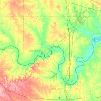
Name: Love County topographic map, elevation, terrain.
Location: Love County, Oklahoma, United States (33.71781 -97.56107 34.07118 -96.93474)
Average elevation: 258 m
Minimum elevation: 185 m
Maximum elevation: 399 m