
兵团六十九团 topographic map
Interactive map
Click on the map to display elevation.
About this map
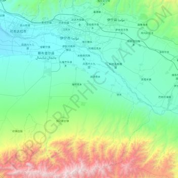
Name: 兵团六十九团 topographic map, elevation, terrain.
Location: 兵团六十九团, Chapchal Xibe Autonomous County, Ili, Xinjiang, China (43.55536 80.57442 43.85718 81.52923)
Average elevation: 1,167 m
Minimum elevation: 555 m
Maximum elevation: 3,673 m