
Deodate topographic map
Interactive map
Click on the map to display elevation.
About this map
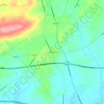
Name: Deodate topographic map, elevation, terrain.
Average elevation: 160 m
Minimum elevation: 125 m
Maximum elevation: 248 m
Other topographic maps
Click on a map to view its topography, its elevation and its terrain.
Bachmanville
United States > Pennsylvania > Dauphin County > Conewago Township
Bachmanville, Conewago Township, Dauphin County, Pennsylvania, 17010, United States
Average elevation: 165 m