
Bolenberg topographic map
Interactive map
Click on the map to display elevation.
About this map
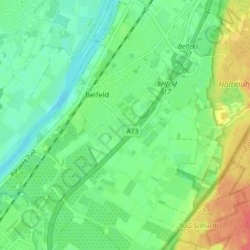
Name: Bolenberg topographic map, elevation, terrain.
Average elevation: 28 m
Minimum elevation: 9 m
Maximum elevation: 63 m
Other topographic maps
Click on a map to view its topography, its elevation and its terrain.
Geloërveld
Geloërveld, Belfeld, Venlo, Limburg, Nederland, 5951 DH, Nederland
Average elevation: 27 m