
Thurnau topographic map
Interactive map
Click on the map to display elevation.
About this map
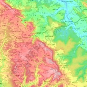
Name: Thurnau topographic map, elevation, terrain.
Location: Thurnau, Landkreis Kulmbach, Bayern, 95349, Deutschland (49.93374 11.32725 50.06591 11.46692)
Average elevation: 433 m
Minimum elevation: 297 m
Maximum elevation: 582 m
Other topographic maps
Click on a map to view its topography, its elevation and its terrain.
Kasendorf
Deutschland > Bayern > Landkreis Kulmbach
Kasendorf, Kasendorf (VGem), Landkreis Kulmbach, Bayern, 95359, Deutschland
Average elevation: 425 m
Marktleugast
Deutschland > Bayern > Landkreis Kulmbach
Marktleugast, Marktleugast (VGem), Landkreis Kulmbach, Bayern, Deutschland
Average elevation: 561 m