
Duchesne County topographic map
Interactive map
Click on the map to display elevation.
About this map
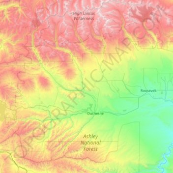
Name: Duchesne County topographic map, elevation, terrain.
Location: Duchesne County, Utah, United States of America (39.80617 -110.90499 40.83482 -109.97692)
Average elevation: 2,408 m
Minimum elevation: 1,408 m
Maximum elevation: 4,096 m
Other topographic maps
Click on a map to view its topography, its elevation and its terrain.
Salt Lake County
United States of America > Utah
Salt Lake County, Utah, United States of America
Average elevation: 1,811 m