
Göttingerode topographic map
Interactive map
Click on the map to display elevation.
About this map
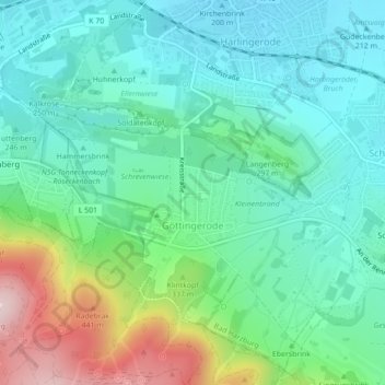
Name: Göttingerode topographic map, elevation, terrain.
Average elevation: 288 m
Minimum elevation: 201 m
Maximum elevation: 526 m
Other topographic maps
Click on a map to view its topography, its elevation and its terrain.
Bad Harzburg (Innenstadt)
Duitsland > Nedersaksen > Landkreis Goslar > Bad Harzburg
Bad Harzburg (Innenstadt), Bad Harzburg, Landkreis Goslar, Nedersaksen, Duitsland
Average elevation: 478 m