
腊市镇 topographic map
Interactive map
Click on the map to display elevation.
About this map
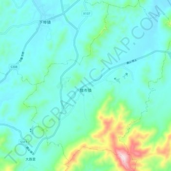
Name: 腊市镇 topographic map, elevation, terrain.
Location: 腊市镇, 湘东区, 萍乡市, 江西省, 中国 (27.50909 113.67113 27.59421 113.75681)
Average elevation: 168 m
Minimum elevation: 72 m
Maximum elevation: 613 m
Other topographic maps
Click on a map to view its topography, its elevation and its terrain.