
Trévani topographic map
Interactive map
Click on the map to display elevation.
About this map
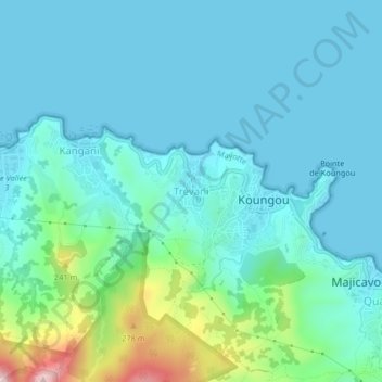
Name: Trévani topographic map, elevation, terrain.
Location: Trévani, Koungou, Mayotte, 97600, France (-12.75487 45.17896 -12.71487 45.21896)
Average elevation: 63 m
Minimum elevation: 0 m
Maximum elevation: 374 m
Other topographic maps
Click on a map to view its topography, its elevation and its terrain.