
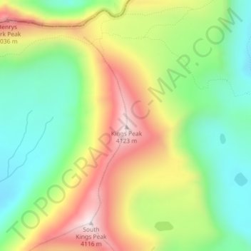
Kings Peak topographic map
Interactive map
Click on the map to display elevation.
About this map
Name: Kings Peak topographic map, elevation, terrain.
Location: Kings Peak, Duchesne County, Utah, États-Unis d'Amérique (40.77619 -110.37285 40.77629 -110.37275)
Average elevation: 3,743 m
Minimum elevation: 3,469 m
Maximum elevation: 4,118 m
Avec 4 123 mètres d'altitude, c'est le point culminant de l'État. Il est nommé d'après le géologue et alpiniste Clarence King.