
Largy topographic map
Interactive map
Click on the map to display elevation.
About this map
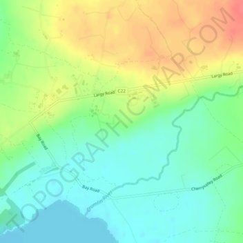
Name: Largy topographic map, elevation, terrain.
Location: Largy, Aldergrove, County Antrim, Irlande du Nord, Royaume-Uni (54.61374 -6.27578 54.62843 -6.25107)
Average elevation: 33 m
Minimum elevation: 9 m
Maximum elevation: 68 m
Other topographic maps
Click on a map to view its topography, its elevation and its terrain.
Ballyquillin
Royaume-Uni > Irlande du Nord > Aldergrove
Ballyquillin, Aldergrove, County Antrim, Irlande du Nord, Royaume-Uni
Average elevation: 52 m
Dungonnell
Royaume-Uni > Irlande du Nord > Aldergrove
Dungonnell, Aldergrove, County Antrim, Irlande du Nord, Royaume-Uni
Average elevation: 50 m