
Kenner topographic map
Interactive map
Click on the map to display elevation.
Kenner
Kenner's coordinates are 30°0′35″N 90°15′2″W / 30.00972°N 90.25056°W / 30.00972; -90.25056 (30.009610, −90.250585),[7] and the city has an elevation of 0 ft (0 m) above sea level.[8] According to the United States Census Bureau, the city has a total area of 15.2 square miles (39 km2), of which 15.1 square miles (39 km2) is land and 0.1 square miles (0.26 km2) (0.7%) is water.
About this map
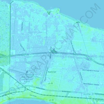
Name: Kenner topographic map, elevation, terrain.
Location: Kenner, Jefferson Parish, Louisiana, United States (29.96914 -90.28023 30.04998 -90.22138)
Average elevation: 1 m
Minimum elevation: -4 m
Maximum elevation: 8 m