
桐棉镇 topographic map
Interactive map
Click on the map to display elevation.
About this map
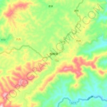
Name: 桐棉镇 topographic map, elevation, terrain.
Location: 桐棉镇, 宁明县, 崇左市, 广西壮族自治区, 中国 (21.77614 107.26479 21.85614 107.34479)
Average elevation: 507 m
Minimum elevation: 303 m
Maximum elevation: 799 m
Other topographic maps
Click on a map to view its topography, its elevation and its terrain.