
Scappoose topographic map
Interactive map
Click on the map to display elevation.
About this map
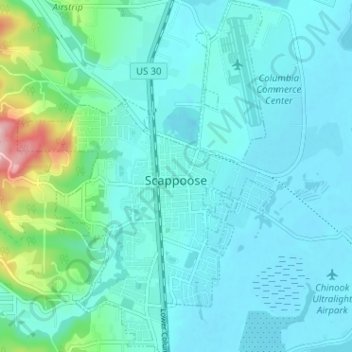
Name: Scappoose topographic map, elevation, terrain.
Location: Scappoose, Columbia County, Oregon, United States (45.73554 -122.90313 45.78002 -122.85650)
Average elevation: 31 m
Minimum elevation: 0 m
Maximum elevation: 209 m
Other topographic maps
Click on a map to view its topography, its elevation and its terrain.
Rainier
United States > Oregon > Columbia County
Rainier, Columbia County, Oregon, United States
Average elevation: 123 m
Saint Helens
United States > Oregon > Columbia County
Saint Helens, Columbia County, Oregon, 97051, United States
Average elevation: 27 m