
Manson topographic map
Interactive map
Click on the map to display elevation.
About this map
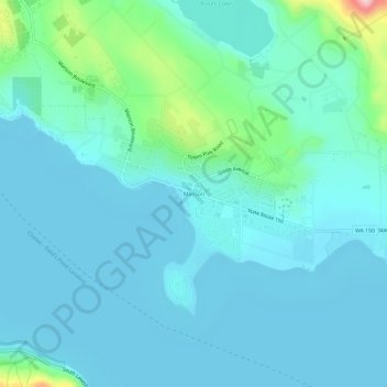
Name: Manson topographic map, elevation, terrain.
Location: Manson, Chelan County, Washington, 98831, United States (47.86486 -120.17841 47.90486 -120.13841)
Average elevation: 362 m
Minimum elevation: 331 m
Maximum elevation: 551 m
Other topographic maps
Click on a map to view its topography, its elevation and its terrain.
Wenatchee
United States > Washington > Chelan County
Wenatchee, Chelan County, Washington, 98801, United States
Average elevation: 302 m
Leavenworth
United States > Washington > Chelan County
Leavenworth, Chelan County, Washington, United States
Average elevation: 418 m
Lake Chelan
United States > Washington > Chelan County > Chelan
Lake Chelan, Chelan, Chelan County, Washington, United States
Average elevation: 1,358 m
Glory Mountain
United States > Washington > Chelan County
Glory Mountain, Chelan County, Washington, United States
Average elevation: 1,562 m
Colchuck Lake
United States > Washington > Chelan County
Colchuck Lake, Chelan County, Washington, United States
Average elevation: 1,886 m
Lake Wenatchee
United States > Washington > Chelan County
Lake Wenatchee, Chelan County, Washington, United States
Average elevation: 874 m
Entiat
United States > Washington > Chelan County
Entiat, Chelan County, Washington, United States
Average elevation: 376 m
Peshastin
United States > Washington > Chelan County
Peshastin, Chelan County, Washington, 98847, United States
Average elevation: 417 m
Coles Corner
United States > Washington > Chelan County
Coles Corner, Chelan County, Washington, United States
Average elevation: 749 m
Dryden
United States > Washington > Chelan County
Dryden, Chelan County, Washington, 98821, United States
Average elevation: 389 m
Maplecreek
United States > Washington > Chelan County
Maplecreek, Chelan County, Washington, United States
Average elevation: 496 m
Lucerne
United States > Washington > Chelan County
Lucerne, Chelan County, Washington, United States
Average elevation: 522 m
Chelan Falls
United States > Washington > Chelan County
Chelan Falls, Chelan County, Washington, 98817, United States
Average elevation: 404 m
Ardenvoir
United States > Washington > Chelan County
Ardenvoir, Chelan County, Washington, 98811, United States
Average elevation: 608 m
Wenatchee Confluence State Park
United States > Washington > Chelan County > Sunnyslope
Wenatchee Confluence State Park, US 2;US 97, Sunnyslope, Chelan County, Washington, 98801, United States
Average elevation: 208 m
Glasses Lake
United States > Washington > Chelan County
Glasses Lake, Chelan County, Washington, United States
Average elevation: 1,369 m
Goode Mountain
United States > Washington > Chelan County
Goode Mountain, Chelan County, Washington, United States
Average elevation: 2,034 m
Lake Chelan Hills
United States > Washington > Chelan County > Chelan
Lake Chelan Hills, Chelan, Chelan County, Washington, 98816, United States
Average elevation: 420 m
Plain
United States > Washington > Chelan County
Plain, Chelan County, Washington, United States
Average elevation: 673 m
Cashmere
United States > Washington > Chelan County
Cashmere, Chelan County, Washington, United States
Average elevation: 298 m
Olds
United States > Washington > Chelan County
Olds, Chelan County, Washington, 98801, United States
Average elevation: 229 m
Jay Peak
United States > Washington > Chelan County
Jay Peak, Chelan County, Washington, United States
Average elevation: 1,829 m
Sunnyslope
United States > Washington > Chelan County
Sunnyslope, Chelan County, Washington, United States
Average elevation: 384 m
Leavenworth
United States > Washington > Chelan County > Leavenworth > Leavenworth
Leavenworth, Chelan County, Washington, 98826, United States
Average elevation: 604 m
Devil's Head
United States > Washington > Chelan County
Devil's Head, Chelan County, Washington, United States
Average elevation: 1,661 m
Stayman
United States > Washington > Chelan County > Stayman
Stayman, Chelan County, Washington, United States
Average elevation: 391 m
Malaga
United States > Washington > Chelan County
Malaga, Chelan County, Washington, 98828, United States
Average elevation: 269 m
Bear Lake
United States > Washington > Chelan County
Bear Lake, Chelan County, Washington, United States
Average elevation: 1,855 m
Chelan
United States > Washington > Chelan County
Chelan, Chelan County, Washington, United States
Average elevation: 558 m