
The Blue Mountains topographic map
Interactive map
Click on the map to display elevation.
About this map
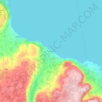
Name: The Blue Mountains topographic map, elevation, terrain.
Location: The Blue Mountains, Grey County, Ontario, N0H 2P0, Canada (44.40170 -80.61011 44.72170 -80.29011)
Average elevation: 265 m
Minimum elevation: 173 m
Maximum elevation: 531 m