
Pealiquor Landing topographic map
Interactive map
Click on the map to display elevation.
About this map
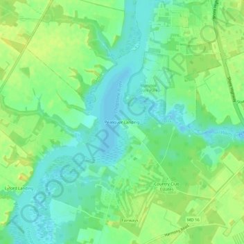
Name: Pealiquor Landing topographic map, elevation, terrain.
Average elevation: 10 m
Minimum elevation: -2 m
Maximum elevation: 21 m
Other topographic maps
Click on a map to view its topography, its elevation and its terrain.
Ridgely
United States > Maryland > Caroline County
Ridgely, Caroline County, Maryland, 21660, United States
Average elevation: 18 m
Choptank
United States > Maryland > Caroline County
Choptank, Caroline County, Maryland, United States
Average elevation: 5 m
Federalsburg Estates
United States > Maryland > Caroline County
Federalsburg Estates, Caroline County, Maryland, United States
Average elevation: 15 m
Federalsburg
United States > Maryland > Caroline County
Federalsburg, Caroline County, Maryland, United States
Average elevation: 10 m
Lynn Woods
United States > Maryland > Caroline County > Lynn Woods
Lynn Woods, Caroline County, Maryland, United States
Average elevation: 16 m