
稲毛区 topographic map
Interactive map
Click on the map to display elevation.
About this map
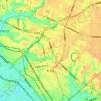
Name: 稲毛区 topographic map, elevation, terrain.
Location: 稲毛区, Chiba, Préfecture de Chiba, Japon (35.62015 140.07380 35.67921 140.15669)
Average elevation: 20 m
Minimum elevation: -4 m
Maximum elevation: 35 m
Other topographic maps
Click on a map to view its topography, its elevation and its terrain.