
Marais de Droitaumont topographic map
Interactive map
Click on the map to display elevation.
About this map
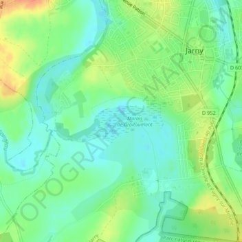
Name: Marais de Droitaumont topographic map, elevation, terrain.
Average elevation: 201 m
Minimum elevation: 185 m
Maximum elevation: 226 m
Other topographic maps
Click on a map to view its topography, its elevation and its terrain.
Saulxure
France > Grand Est > Meurthe-et-Moselle > Jarny
Saulxure, Les Cités de la Gare, Jarny, Briey, Meurthe-et-Moselle, Grand Est, France métropolitaine, 54800, France
Average elevation: 200 m
Château de Moncel
France > Grand Est > Meurthe-et-Moselle > Jarny
Château de Moncel, Rue Émile Bouchotte, Ferme de Moncel, Jarny, Val-de-Briey, Meurthe-et-Moselle, Grand Est, France métropolitaine, 54800, France
Average elevation: 206 m