
Cité des Castors topographic map
Interactive map
Click on the map to display elevation.
About this map
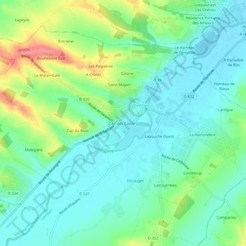
Name: Cité des Castors topographic map, elevation, terrain.
Average elevation: 191 m
Minimum elevation: 163 m
Maximum elevation: 261 m
Other topographic maps
Click on a map to view its topography, its elevation and its terrain.
La Ramondère
France > Occitanie > Gers > Lombez
La Ramondère, Lombez, Auch, Gers, Occitanie, France métropolitaine, 32220, France
Average elevation: 188 m