
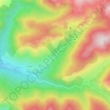
L'Eycherque topographic map
Interactive map
Click on the map to display elevation.
About this map
Name: L'Eycherque topographic map, elevation, terrain.
Average elevation: 1,442 m
Minimum elevation: 1,080 m
Maximum elevation: 1,823 m
Other topographic maps
Click on a map to view its topography, its elevation and its terrain.
Port de Pailleres
France > Occitanie > Ariège > Ascou
Port de Pailleres, Ascou, Foix, Ariège, Occitanie, France métropolitaine, 09110, France
Average elevation: 1,812 m
Jasse de Cabane Longue
France > Occitanie > Ariège > Ascou
Jasse de Cabane Longue, Ascou, Foix, Ariège, Occitanie, France métropolitaine, 09110, France
Average elevation: 1,601 m