
Pollinkhove topographic map
Interactive map
Click on the map to display elevation.
About this map
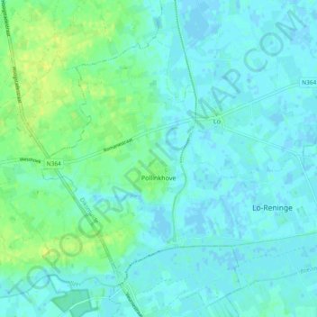
Name: Pollinkhove topographic map, elevation, terrain.
Location: Pollinkhove, Lo-Reninge, Dixmude, Flandre-Occidentale, Belgique (50.95041 2.69644 50.99534 2.78951)
Average elevation: 4 m
Minimum elevation: -2 m
Maximum elevation: 15 m
Other topographic maps
Click on a map to view its topography, its elevation and its terrain.
Noordschote
Belgique > Flandre-Occidentale > Dixmude > Lo-Reninge
Noordschote, Lo-Reninge, Dixmude, Flandre-Occidentale, Belgique
Average elevation: 3 m
Reninge
Belgique > Flandre-Occidentale > Dixmude > Lo-Reninge
Reninge, Lo-Reninge, Dixmude, Flandre-Occidentale, Flandre, Belgique
Average elevation: 5 m