
Thank you for supporting this site ❤️
Make a donation
Make a donation
Al Mashaba topographic map
Click on the map to display elevation.
Thank you for supporting this site ❤️
Make a donation
Make a donation
About this map
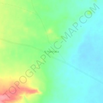
Name: Al Mashaba topographic map, elevation, terrain.
Location: Al Mashaba, Mellit District, North Darfur, Sudan (14.04021 25.75987 14.08021 25.79987)
Average elevation: 805 m
Minimum elevation: 771 m
Maximum elevation: 878 m
Thank you for supporting this site ❤️
Make a donation
Make a donation