
Bayan-Ölgii topographic map
Interactive map
Click on the map to display elevation.
About this map
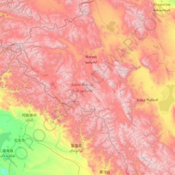
Name: Bayan-Ölgii topographic map, elevation, terrain.
Location: Bayan-Ölgii, Mongolia (46.54169 87.73459 50.00122 91.92712)
Average elevation: 2,013 m
Minimum elevation: 385 m
Maximum elevation: 4,141 m
The Khovd River (the longest in the western Mongolian Great Lakes Depression) has its origin in this aimag. It is fed by the three lakes Khoton, Khurgan, and Dayan, and in turn feeds the lake Khar-Us in the Khovd Aimag. The Tolbo Lake is a large saline lake about 50 km south of the aimag capital. It features clear and cold water on an elevation of 2,080 m.
Other topographic maps
Click on a map to view its topography, its elevation and its terrain.