
香川郡 topographic map
Interactive map
Click on the map to display elevation.
About this map
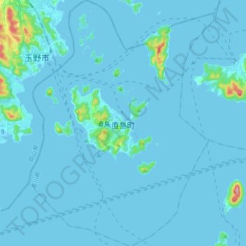
Name: 香川郡 topographic map, elevation, terrain.
Location: Naoshima, 香川郡, Préfecture de Kagawa, Shikoku, Japon (34.40188 133.94274 34.52326 134.04954)
Average elevation: 9 m
Minimum elevation: -3 m
Maximum elevation: 184 m
Other topographic maps
Click on a map to view its topography, its elevation and its terrain.