
Thank you for supporting this site ❤️
Make a donation
Make a donation
Hepberg topographic map
Click on the map to display elevation.
Thank you for supporting this site ❤️
Make a donation
Make a donation
About this map
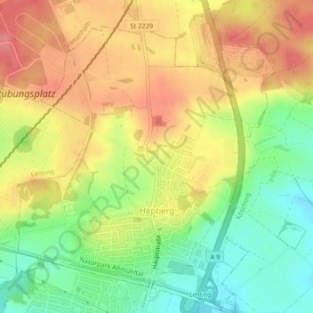
Name: Hepberg topographic map, elevation, terrain.
Location: Hepberg, Landkreis Eichstätt, Bayern, 85120, Deutschland (48.81682 11.44336 48.83939 11.47733)
Average elevation: 434 m
Minimum elevation: 392 m
Maximum elevation: 471 m
Thank you for supporting this site ❤️
Make a donation
Make a donation
Other topographic maps
Click on a map to view its topography, its elevation and its terrain.