
Quito Canton topographic map
Interactive map
Click on the map to display elevation.
About this map
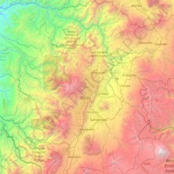
Name: Quito Canton topographic map, elevation, terrain.
Location: Quito Canton, Pichincha, Ecuador (-0.59568 -78.94768 0.25627 -78.16490)
Average elevation: 2,683 m
Minimum elevation: 500 m
Maximum elevation: 5,673 m
Other topographic maps
Click on a map to view its topography, its elevation and its terrain.