
เขาหลัก topographic map
Interactive map
Click on the map to display elevation.
About this map
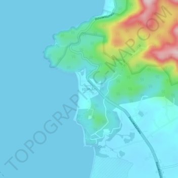
Name: เขาหลัก topographic map, elevation, terrain.
Location: เขาหลัก, ลำแก่น, Phang-nga, 82210, Thailand (8.59258 98.21927 8.63258 98.25927)
Average elevation: 37 m
Minimum elevation: -2 m
Maximum elevation: 296 m
Other topographic maps
Click on a map to view its topography, its elevation and its terrain.