
Marsh Harbour topographic map
Interactive map
Click on the map to display elevation.
About this map
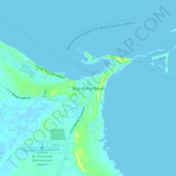
Name: Marsh Harbour topographic map, elevation, terrain.
Location: Marsh Harbour, Central Abaco, The Bahamas (26.49827 -77.10104 26.57827 -77.02104)
Average elevation: 2 m
Minimum elevation: -2 m
Maximum elevation: 20 m
Other topographic maps
Click on a map to view its topography, its elevation and its terrain.