
Chinsali District topographic map
Interactive map
Click on the map to display elevation.
Chinsali District
It lies on the watershed between the Chambeshi River in the Congo Basin and the Luangwa River in the Zambezi basin. The north-eastern half of the district is relatively flat plateau, especially along the Chambeshi, of 1200–1300 m elevation but the south-western half has an attractive landscape of granite hills with an elevation of 1500–1600 m, where the country estate of Shiwa Ngandu is located.
About this map
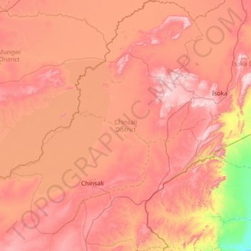
Name: Chinsali District topographic map, elevation, terrain.
Location: Chinsali District, Muchinga Province, Zambia (-10.84829 31.69932 -9.74235 32.56816)
Average elevation: 1,234 m
Minimum elevation: 691 m
Maximum elevation: 1,697 m
Other topographic maps
Click on a map to view its topography, its elevation and its terrain.