
Bierbeek topographic map
Interactive map
Click on the map to display elevation.
About this map
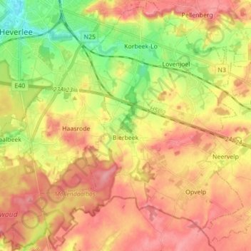
Name: Bierbeek topographic map, elevation, terrain.
Location: Bierbeek, Brabant flamand, Flandre, 3360, Belgique (50.78809 4.69121 50.87564 4.81944)
Average elevation: 71 m
Minimum elevation: 20 m
Maximum elevation: 110 m