
Linn County topographic map
Interactive map
Click on the map to display elevation.
About this map
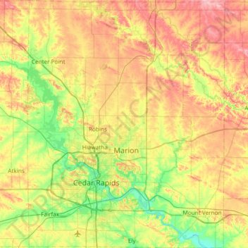
Name: Linn County topographic map, elevation, terrain.
Location: Linn County, Iowa, United States of America (41.85949 -91.83526 42.29905 -91.36329)
Average elevation: 261 m
Minimum elevation: 207 m
Maximum elevation: 335 m
Other topographic maps
Click on a map to view its topography, its elevation and its terrain.
Woodbury County
United States of America > Iowa
Woodbury County, Iowa, United States of America
Average elevation: 376 m
Fremont County
United States of America > Iowa
Fremont County, Iowa, United States of America
Average elevation: 314 m
Fraser
United States of America > Iowa > Fraser
Fraser, Boone County, Iowa, United States of America
Average elevation: 307 m