
Obourg topographic map
Interactive map
Click on the map to display elevation.
About this map
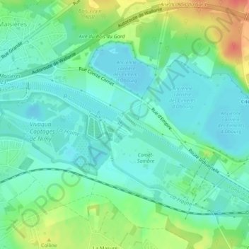
Name: Obourg topographic map, elevation, terrain.
Location: Obourg, Mons, Hainaut, Wallonie, Belgique (50.47892 3.98120 50.47948 3.98254)
Average elevation: 44 m
Minimum elevation: 28 m
Maximum elevation: 80 m
Other topographic maps
Click on a map to view its topography, its elevation and its terrain.
La Poudrière
Belgique > Wallonie > Mons > La Poudrière
La Poudrière, Havré, Mons, Hainaut, Wallonie, 7030, Belgique
Average elevation: 59 m
Bon-Vouloir
Belgique > Wallonie > Mons > Bon-Vouloir
Bon-Vouloir, Havré, Mons, Hainaut, Wallonie, 7021, Belgique
Average elevation: 56 m