
Thank you for supporting this site ❤️
Make a donation
Make a donation
Tuva Republic topographic map
Click on the map to display elevation.
Thank you for supporting this site ❤️
Make a donation
Make a donation
About this map
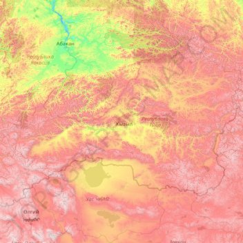
Name: Tuva Republic topographic map, elevation, terrain.
Location: Tuva Republic, Siberian Federal District, Russia (49.74293 88.79200 53.72893 99.27370)
Average elevation: 1,411 m
Minimum elevation: 224 m
Maximum elevation: 3,924 m
Thank you for supporting this site ❤️
Make a donation
Make a donation
Other topographic maps
Click on a map to view its topography, its elevation and its terrain.
Thank you for supporting this site ❤️
Make a donation
Make a donation
Thank you for supporting this site ❤️
Make a donation
Make a donation
Thank you for supporting this site ❤️
Make a donation
Make a donation
Thank you for supporting this site ❤️
Make a donation
Make a donation